
Essential Questions:
EQ 4 - How do you use latitude and longitude to read a map?
Vocabulary
- Map
- Latitude
- Equator
- Tropic of Cancer
- Tropic of Capricorn
- Longitude
- prime meridian
- International date line
- hemisphere
Handouts
|
| ||||
| the_geographer’s_eye_1-2_latitude___longitude.pptx.pptx |
Slideshow

Directions
Preparing to Learn. Students will complete IR-4 using the grid as a guide to write all their classmates names where they sit. Think about what this graphic resembles (a grid), what makes up grids? Where have you seen something like this before? Why are graphics like this helpful? Students will record their answers in their Geographer's Journals.
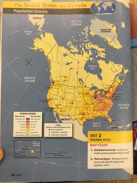
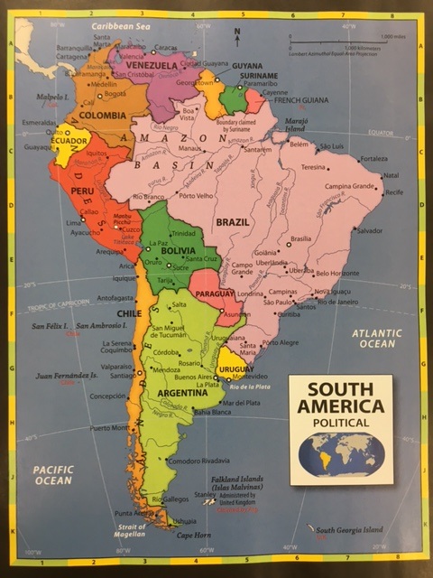
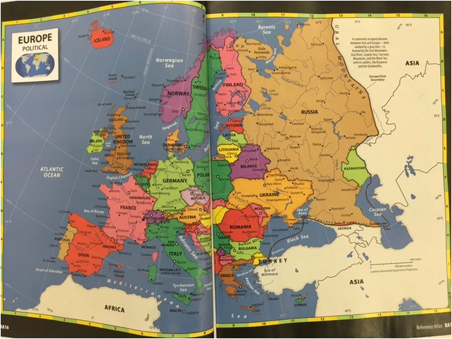
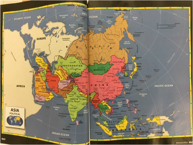
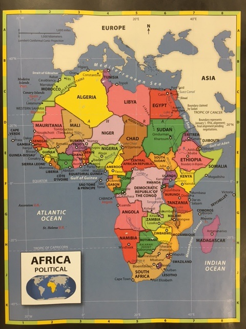
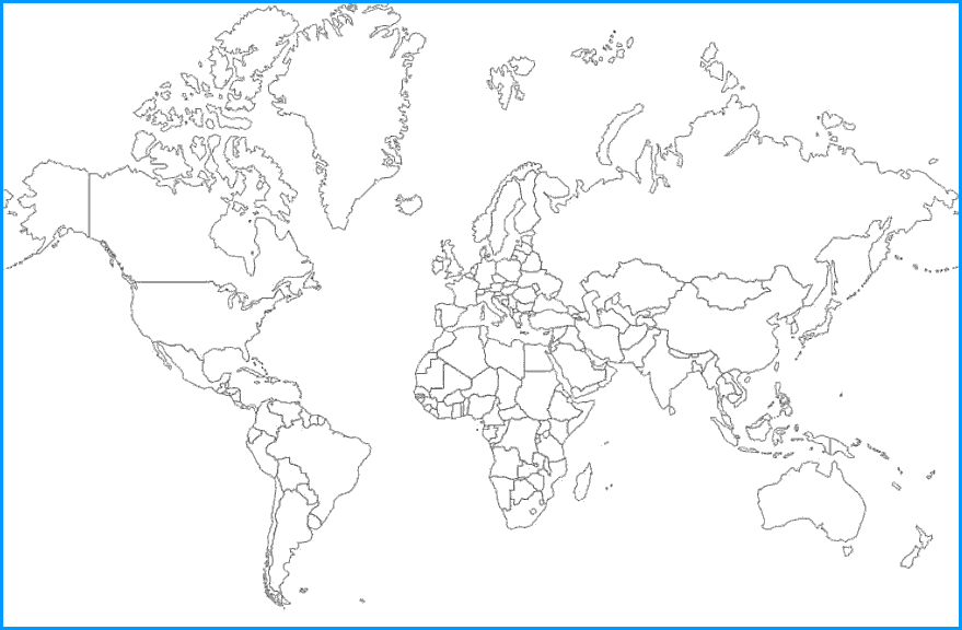
Guided Practice. In pairs, students will use latitude and longitude coordinates listed on IR-5 to find locations on an atlas (like the one pictured above). Students will record their answers in their Geographer's Journals. Next, using the world political outline map, students will locate and label the Equator, Prime Meridian, Tropic of Cancer, Tropic of Capricorn, and the International Date Line. After students have completed finding the locations and labeling the previous items, the class will discuss:
1. What patterns were evident about the spatial relationships between these cities?
2. What do most of these cities share in common about their physical location?
3. What words could be used to name the physical locations that the cities share in common?
Reading to Learn. Students will copy the IR-7 chart in their Geographer's Journals and read the IR-6 handout to complete the chart. As a class we will discuss:
1.How can latitude and longitude lines help in understanding maps?
2. What difficulties do you have when using latitude and longitude?
3. What difficulties do you have when referencing locations by hemispheres?
Analyze. Students will journal their responses in their Geographer's Journal on these questions:
1. Think about the map you labeled using the cities from IR-5, In what hemisphere are the majority of urban settlements located?
2. Why do you think these cities are located in their respective locations?
3. What patterns do you see in the spatial relationships between the cities on your political outline map?
4. What do most of these cities share in common about their physical locations?
Evaluate/Quiz. Students will be quizzed on their ability to locate cities using longitude and latitude coordinates and listing a cities coordinates.
