
Essential Questions:
EQ 5– What is spatial analysis?
EQ 6- How can people use spatial analyses in their lives everyday?
Vocabulary
spatial analysis
cardinal directions
intermediate directions
process
pattern
cardinal directions
intermediate directions
process
pattern
Handouts
Materials for Lesson
|
| ||||
Slideshow
Directions
Pre-assignment/Geographer's Field Work. Students will record 6 family members' names, birthplaces, and explain reasons why they moved or stayed in their birthplace.
Preparing to Learn. Students will describe with words the location of 5 classroom items. Student volunteers will share with the class.
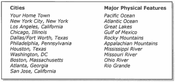
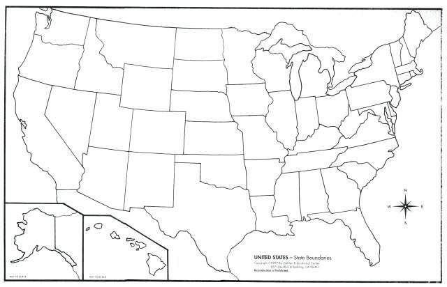
Guided Practice. In groups of 2 to 3, students will label a US political map. Use dots to indicate the location of cities and draw major physical features such as rivers and mountains. After plotting the cities and physical features, students will write in their Geographer's journals describing the relationship between where they live compared to the plotted cities and physical features. They will share their responses with their partner(s). The teacher will then lead a whole class discussion to clarify/verify the information. Students will listen and participate to see if their responses match their classmates. Here is a list of items to include on the map:
Preparing to Learn. Students will describe with words the location of 5 classroom items. Student volunteers will share with the class.
Guided Practice. In groups of 2 to 3, students will label a US political map. Use dots to indicate the location of cities and draw major physical features such as rivers and mountains. After plotting the cities and physical features, students will write in their Geographer's journals describing the relationship between where they live compared to the plotted cities and physical features. They will share their responses with their partner(s). The teacher will then lead a whole class discussion to clarify/verify the information. Students will listen and participate to see if their responses match their classmates. Here is a list of items to include on the map:
|
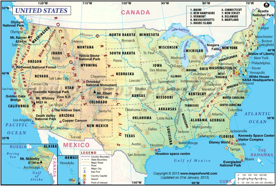
Click the link above for a map.
| ||
Reading to Learn. Students will read handout IR3 and complete IR2 based on the reading; this will be recorded in their Geographer's Journal. Next, students will turn to a partner and try to define Spatial Analyses in their own words, while also explaining 3 important relationships of spatial analyses including space between people, places, and events. Students will also discuss what a Pattern is and how geographers use patterns to analyze geographic information. Next, students will discuss what a Process is and how geographers use processes to analyze geographic information. Finally, students will summarize their learning by writing what the most important thing they have learned in World Geography thus far.
Analyze and Evaluate.Students will respond in their Geographer's Journals to these questions:
1. What do you think is the spatial relationship between where you and your classmates were born versus where you live today?
2. Is it the same or different? How much difference is there?
3. If there are differences, why do you think these differences occur?
Next, student will work in groups of 3 or 4 to map all group members' data recorded about family members' birthplaces and current locations.Students should use a different color map pencil to locate and label each generation (exa. students - blue, parents - red, grandparents - green). After mapping the groups data, students will answer these questions in their Geographers' Journal:
1. What patterns emerged among birthplaces of the students?
2. What patterns emerged among the birthplaces of the parents's generation?
3. What patterns emerged among the birthplaces of the grandparents' generation?
4. What patterns are evident between each generation?
5. Was the reason for movement from the location of someone's birth and where they currently reside one of the following:
a. economic - job opportunity
b. social - education, to be near family
c. political - fleeing persecution or oppression
Finally, students will write a paragraph using the class data to summarize the spatial relationships between the locations of the birthplaces of family relatives and where those same people live today. Explain what factors precipitated the movement. Include at least 3 examples from the class as evidence.
|
| ||||
